I'm still standing
Rest is part of my sabbatical, but so is getting outdoors. I set three (reasonable) goals for myself - hiking Section J (Stevens to Snoqualmie Pass) of the Pacific Crest Trail (PCT), Sierra backpack including Mount Whitney and visiting Yellowstone.
I don't recall what inspired me to hike section J of the PCT. I hiked sections during various backpacking trips to California. Washington is home to ~5 sections of the PCT (Partial of H, and I, J, K and L). Knowing its not likely I'd want to hike the entire PCT (2,650 miles from Mexico to Canada), I set on doing this backyard section to take in the beauty of our state and experience the PCT.
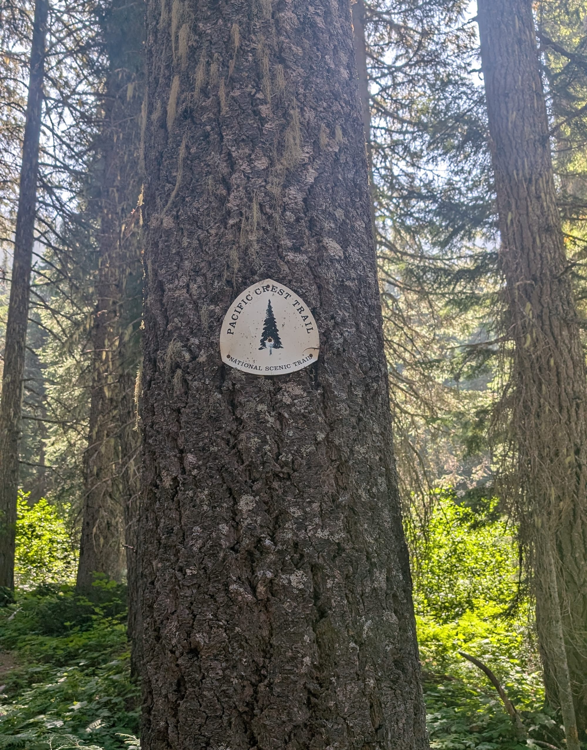
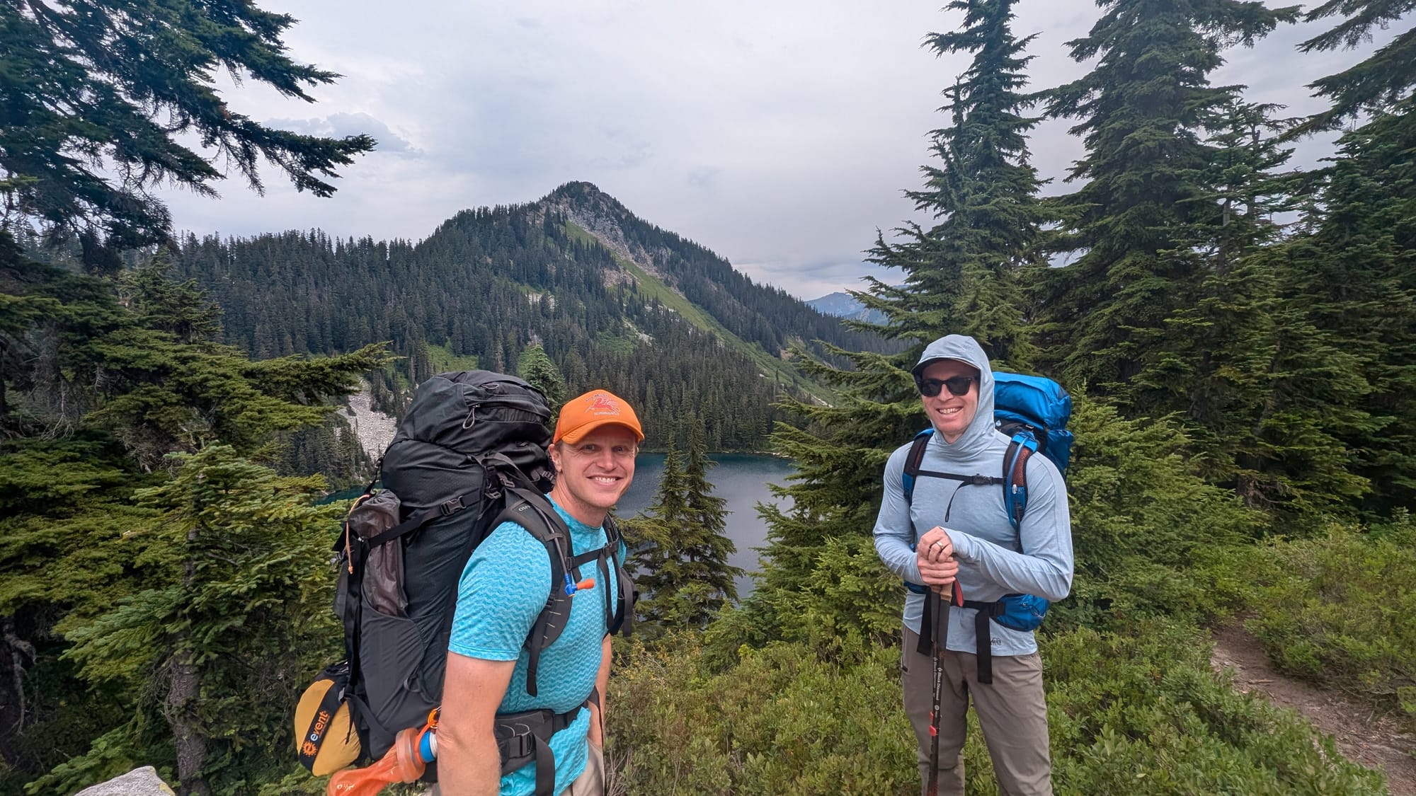
PCT Trail Markings along Section J and We Ready - at the Stevens Pass Trailhead
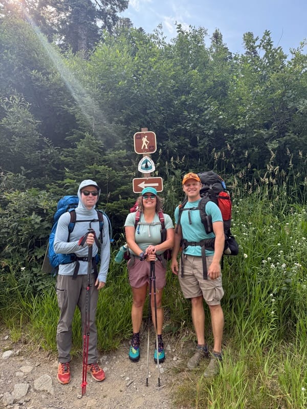
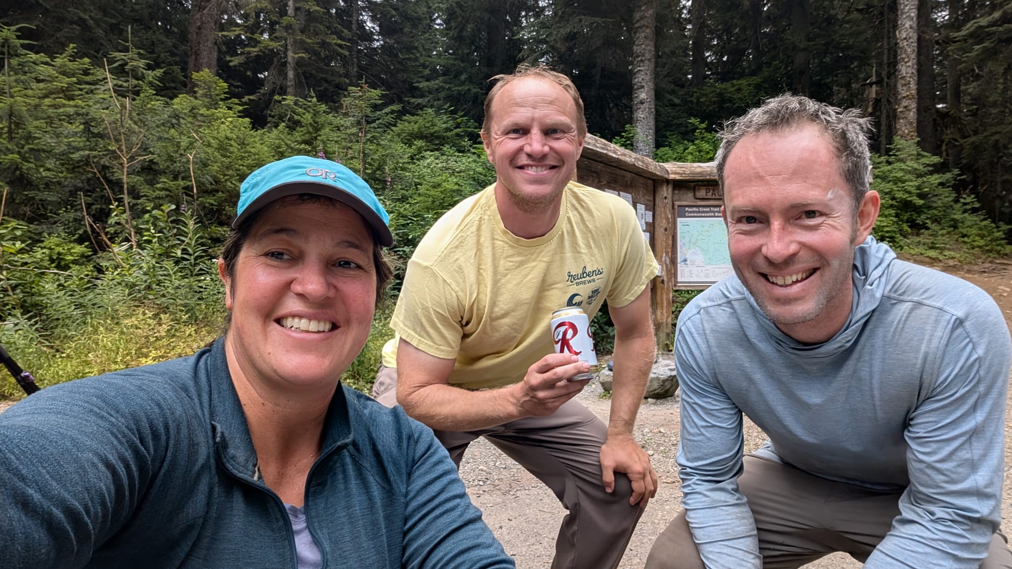
We decided about ten days out to start on Thursday, July 31. On a whim, we asked our friend, Brian, to join us and he accepted our invitation ("no regrets" he says). I chose to do the trip over five days rather than seven. Though I've done longer trips, I had yet to backpack this summer and prefer a shorter shakeout trip to get into a backpacking rhythm. Also, as some of us know, sleeping on the ground, even on a cushy Neo Air mattress, at a certain age, has limitations.
To pull this off, we secured a ride to Stevens Pass on Thursday morning (Thanks Kylene!) and staged a car at the Snoqualmie Pass for Monday exit. The forecast was 30% chance of rain/thunderstorms for the first two days, then sun and partly cloudy for the rest of the trip.
Notes before we get into the trip.
One of my favorite pastimes while hiking/backpacking is to count how many people I see, so those stats are included below.
This will be one of my longer entries going day by day through this trip and a quick trip to Tahoe - all with plenty of photos though!
Finally, for more photos, sharing a Best of Section J Album.
PCT Section J Stats: 5 days, 74.8 Miles, ~14,000 feet of elevation gain
Day 1 Stevens to Trap Lake 11.6 miles (2719 elevation gain)
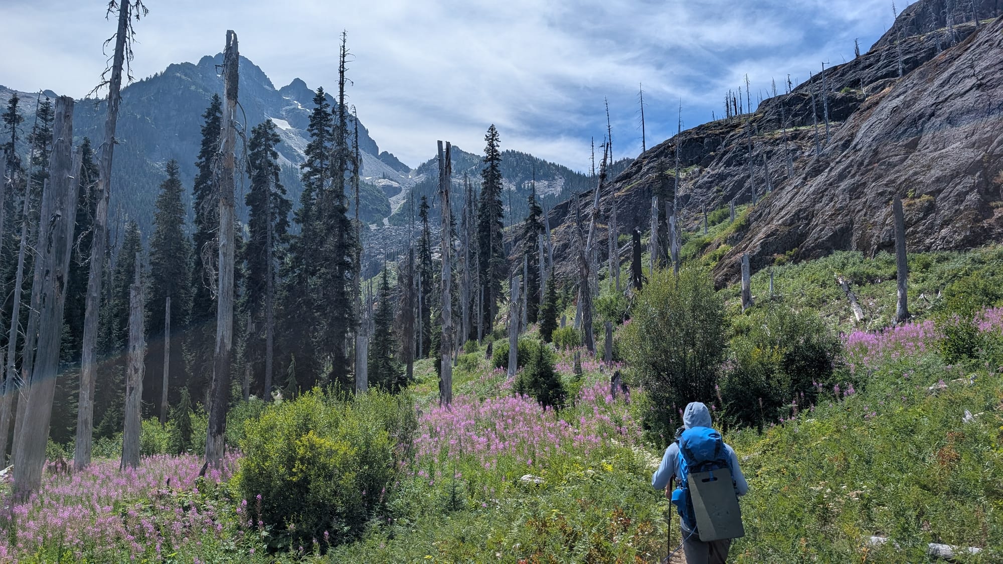
Our ride dropped us off around 10am. In the first hour, we saw ~ 8-10 Northbound PCT hikers (NOBOs) likely set to resupply at Stevens Pass as they head toward Canada. We saw~25-30 people that day, 75% NOBOs. This stretch had many lakes - Josephine, Mig and Hope. We also ran into Mark, a PCT section hiker, who split up his PCT experience over a few years. Unfortunately, Mark lost his wedding ring at a campsite we’d be passing through in two days, so he gave us the coordinates to check the site.
Hiking thorough Stevens Pass Ski Area and Jeremy and Brian above Josephine Lake
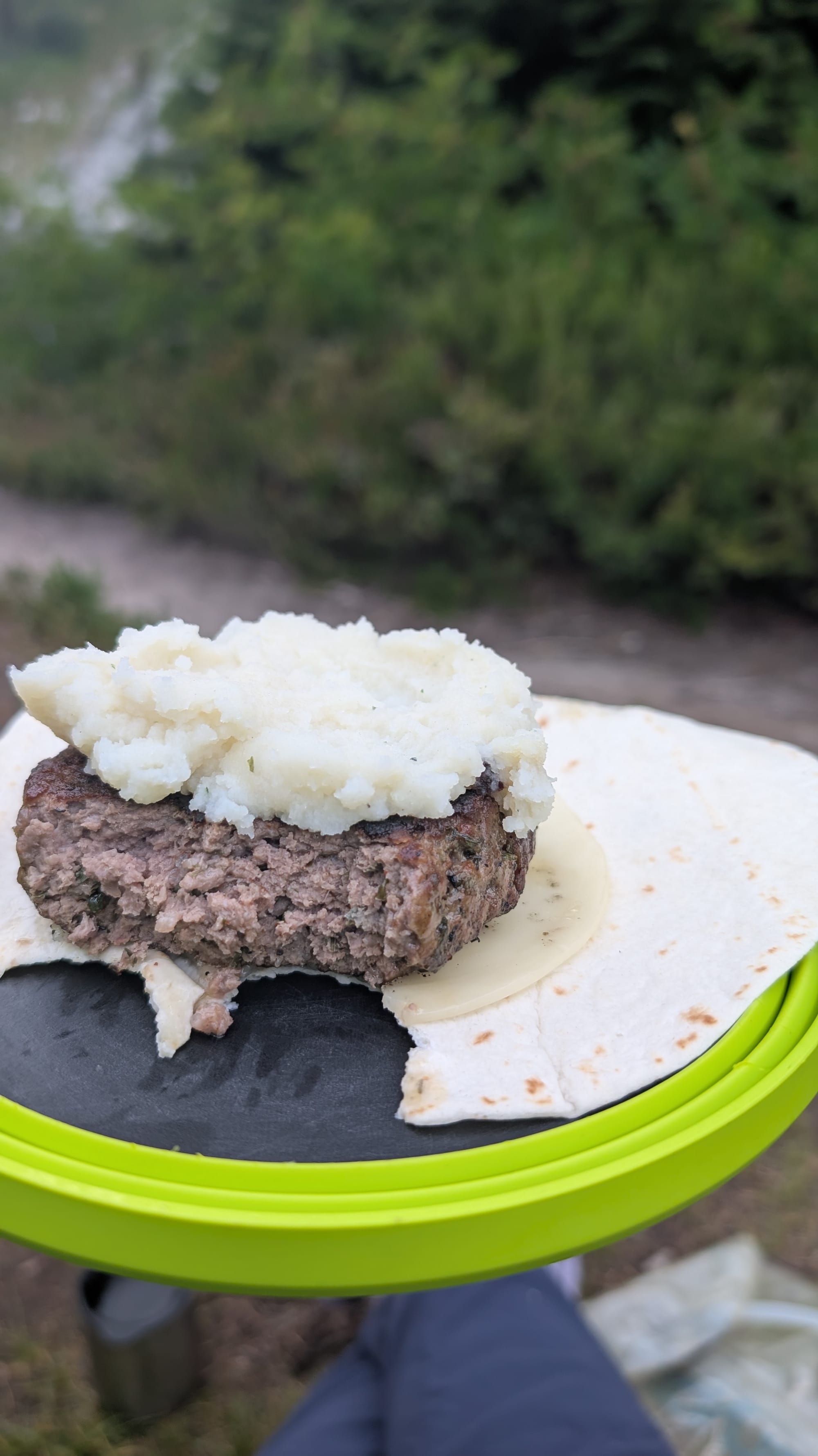
As we headed south, light rain started, keeping the temps cool, but requiring pack covers (no rain gear though). It was a bit humid and sweaty climbing up towards Trap Lake and Trap pass. With a 30% chance of thunderstorms forecast and rain seeming more heavy, we decided to see what Trap Lake offered for camping rather than ascend Trap Pass. We found a nice site, protected from the wind. The sun greeted us briefly around 5pm. We enjoyed Steakhouses burgers from Ballard Market and Idahoians for dinner to fuel us for the coming day.
View towards Thunder Mountain Lakes, Trap Lake and Dinner for our first night
Day 2 Trap Lake to Cathedral Pass 15.7 miles (3364 gain)
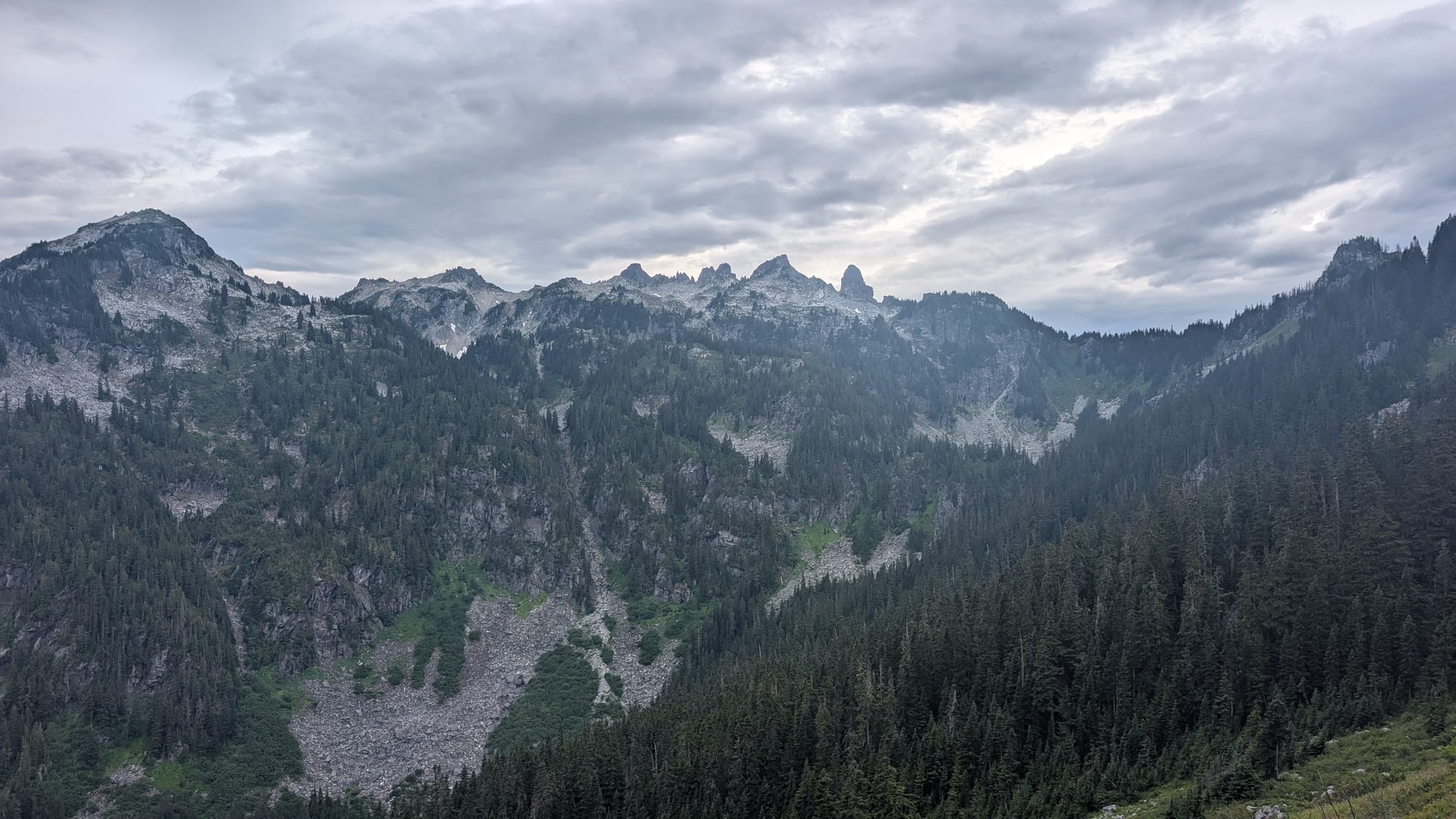
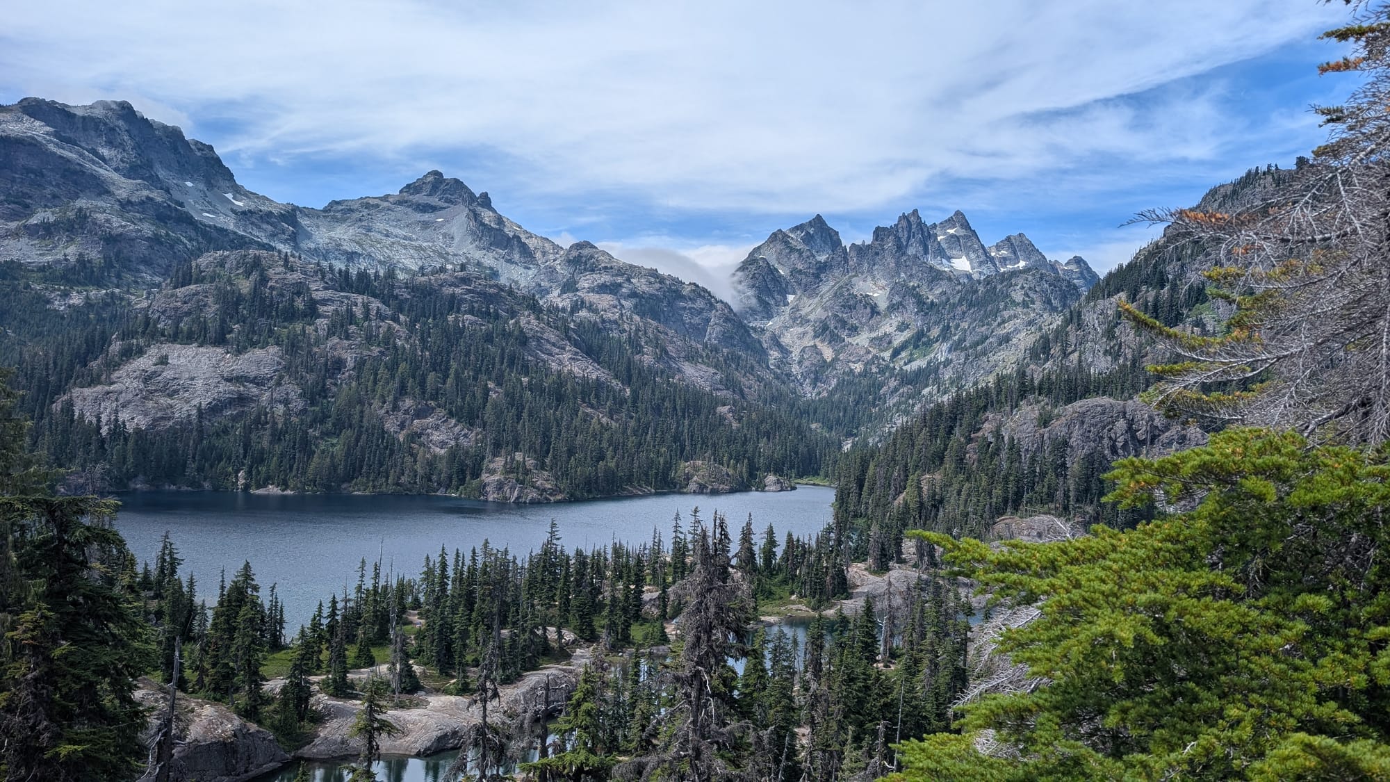
8am start to ascend Trap Pass, dropping down to Surprise and Glacier Lakes and eventually climbing up Pieper (Piper, Noooo!) Pass. This section was buggier with less glamorous campsites. Pieper Pass reminded me of the Sierras. From the pass, we had a long descent to Deception Lakes. We paused for lunch near the lakes, meeting two backpackers doing a trip from Marmot and Jade Lakes up to Thunder Mountain Lakes (which are amazing). We saw 26 people, two trail runners, two day hikers, 5 backpackers and about 17 NOBOs.
From Deception Pass, we descended into a valley where we had to bypass a beautiful canyon with a stream flowing down before beginning our ascent up to Cathedral Pass.
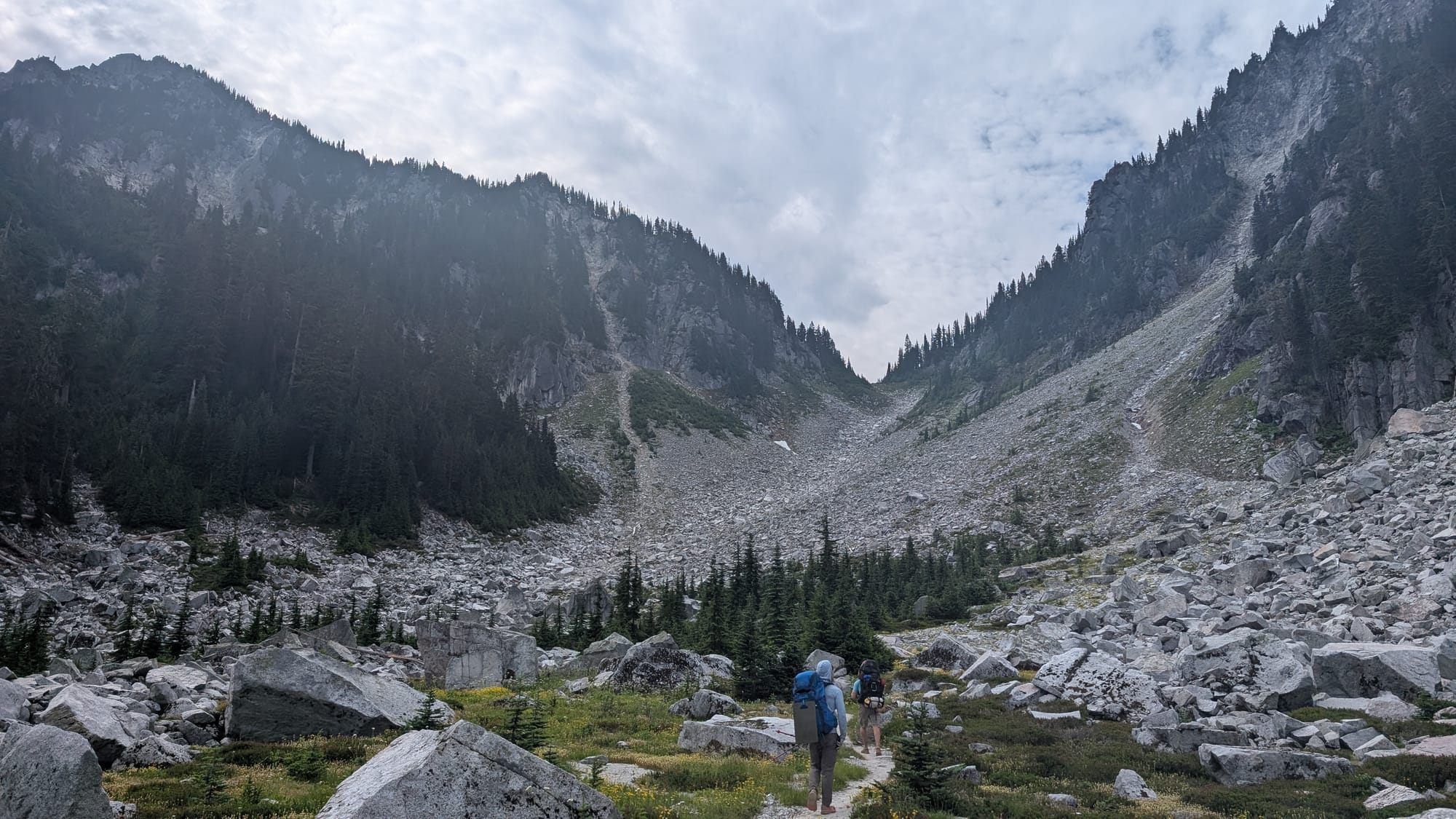

Getting ready to head up Pieper Pass and a canyon water crossing before ascent to Cathedral
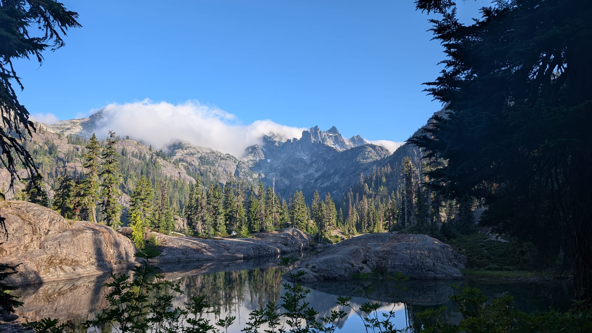
This ascent, would be the first “pain cave” moment on this trip (or Brian's clever nickname "The T-Pain Cave"). It was a long ascent over 4.9 miles to Cathedral pass. We stopped at the coordinates Mark gave us to see if we could find his wedding ring. No luck though. We found a campsite near the Cathedral Pass, thankfully with water a short walk away. After a long day, we dined on chicken avocado melts and enjoyed the views of Tenaway and Mount Stuart (aka Big Stu).


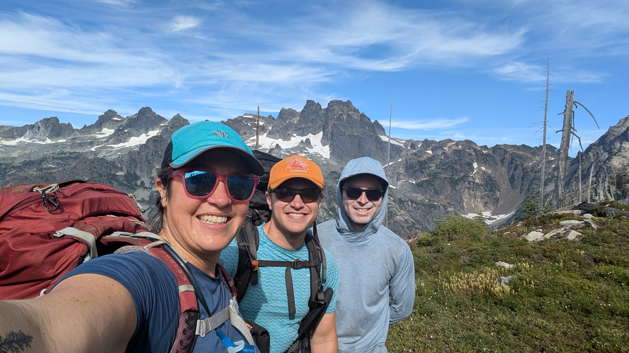
Ascending Pieper Pass, above Glacier Lake; Cathedral Rock and Morning views of Big Stu towards the Enchantments
Day 3 Cathedral Pass to Escondido Ridge 17.9 miles (2500 gain)
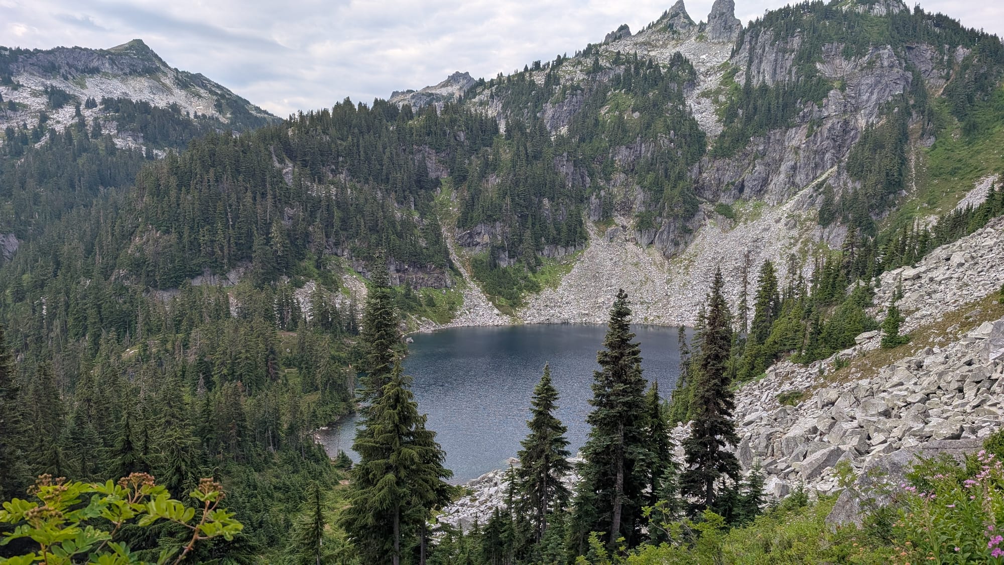
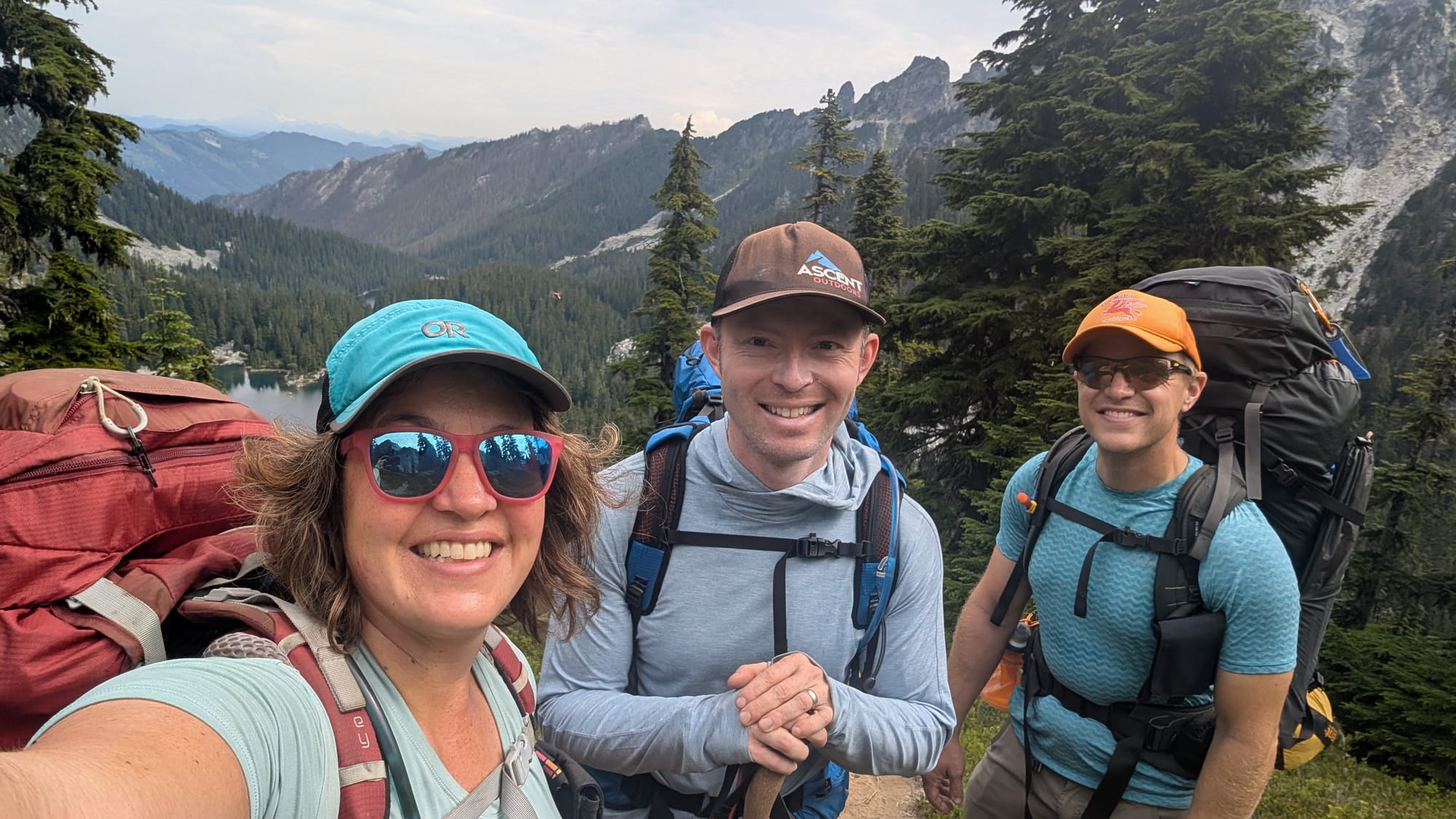
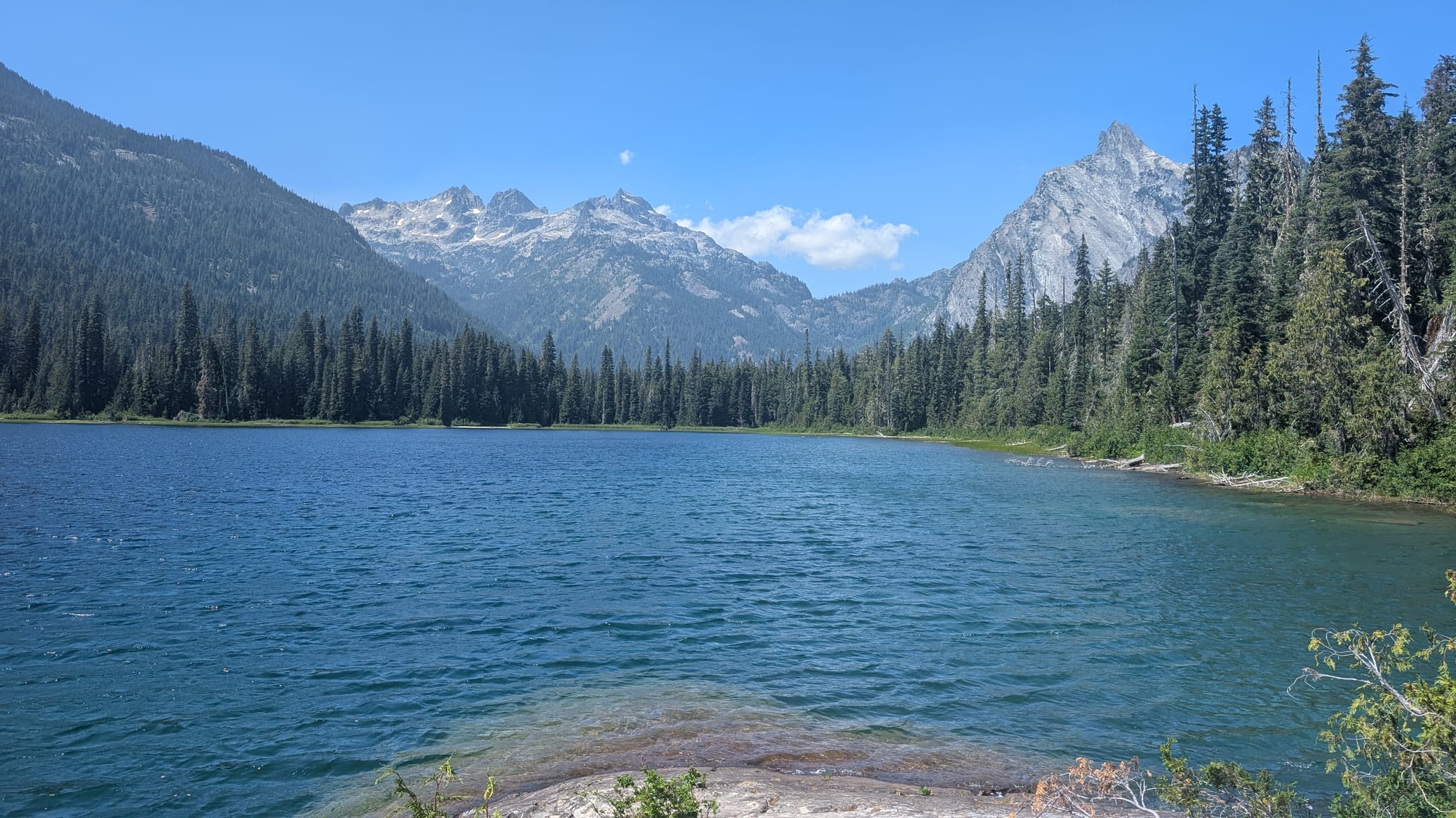
It was a beautiful and dewy morning, making for damp tents and nice light on Mount Stuart. From Cathedral Pass, we descended to Deep Lake where we met friendly mosquitoes, until dropping into the valley adjacent to Spinola Creek. Jeremy and I smelled smoke briefly here, but neither of us mentioned it. We stopped at Waptus Lake for a leisurely lunch and foot soak. The wind kept the bugs at bay for lunch. We filled up on our water here, knowing the climb up Escondido Ridge was likely dry. We crossed the Waptus River, where we ran into a NOBO that mentioned she had “never seen anything like Washington." A nice reminder how lucky we are to live in such a beautiful state with access to many remarkable places.
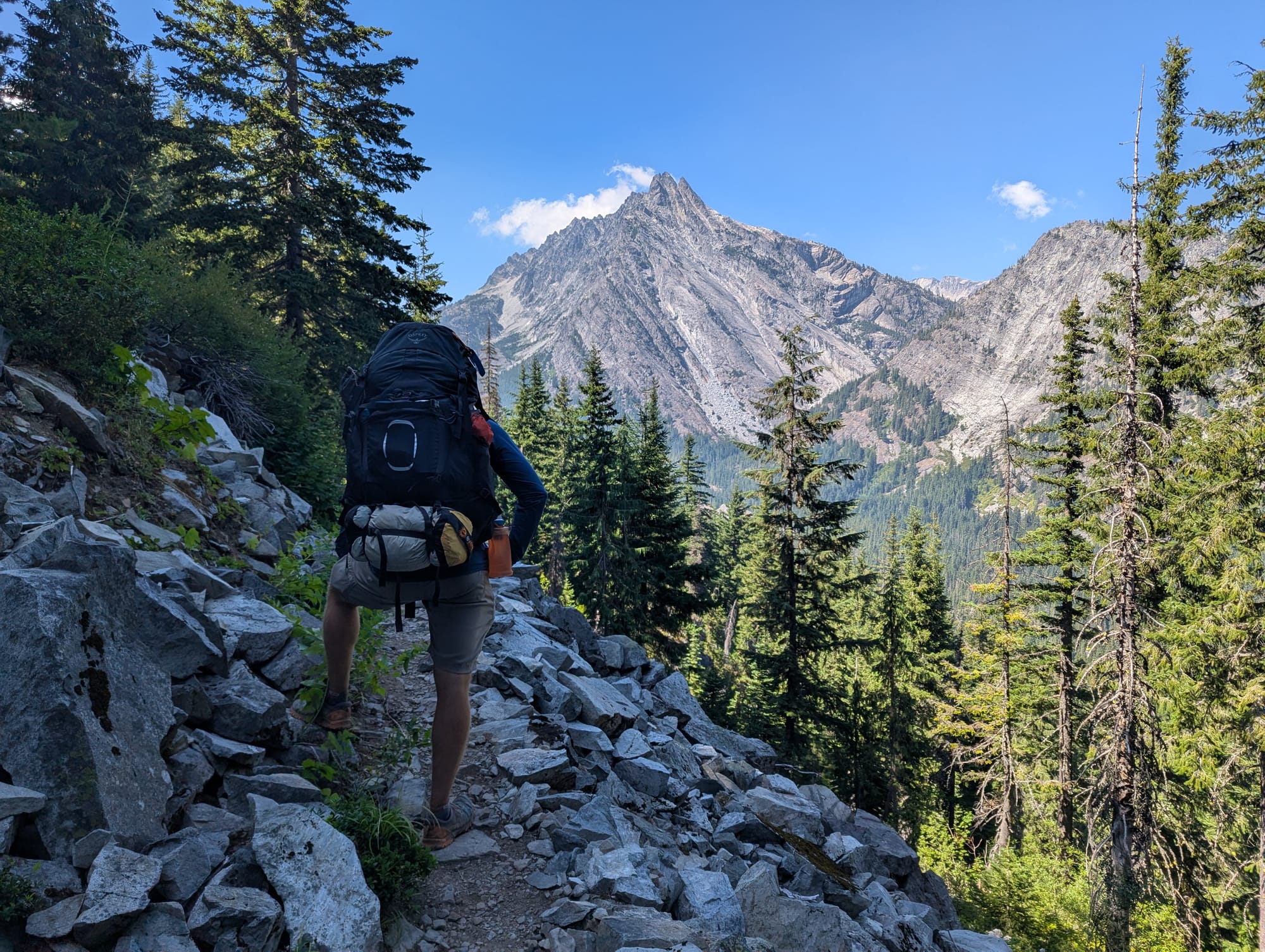
Waptus Lake towards Dutch Miller Gap, Summit Chief and Bears Breast and Headed up Escondido Ridge, with Bears Breast in the background
We began our 4.9 mile ascent up Escondido Ridge. Jeremy and I stopped for a break as Brian continued up the ridge, which helped fuel me to the top. Once we reached the ridge, we had ~1.5 miles more to reach the first lake/water source. This last mileage was tough for me, with tired feet.We made it to camp later than normal, around 7pm. Instead of a planned dinner, we did freeze dry meals after our long day. Via our satellite communicator, we checked with friends about the smoke smell and increasing haze we saw, which likely came from the Bear Gulch fire in the Olympic Mountains (west of Seattle). We saw about 28 people that day, including 2 trail runners, 2 Section J hikers, and about 22 NOBOs.
Day 4 Escondido Ridge to Spectacle Lake 11.6 miles (1465 gain)
We began our morning with a long descent into the valley and Lemah Meadows. Along the ridge, we had amazing views of Lemah and Chimney Rock. This was definitely the section with the most shutter delay (a stopping to take photos). Very North Cascades-esque through here.
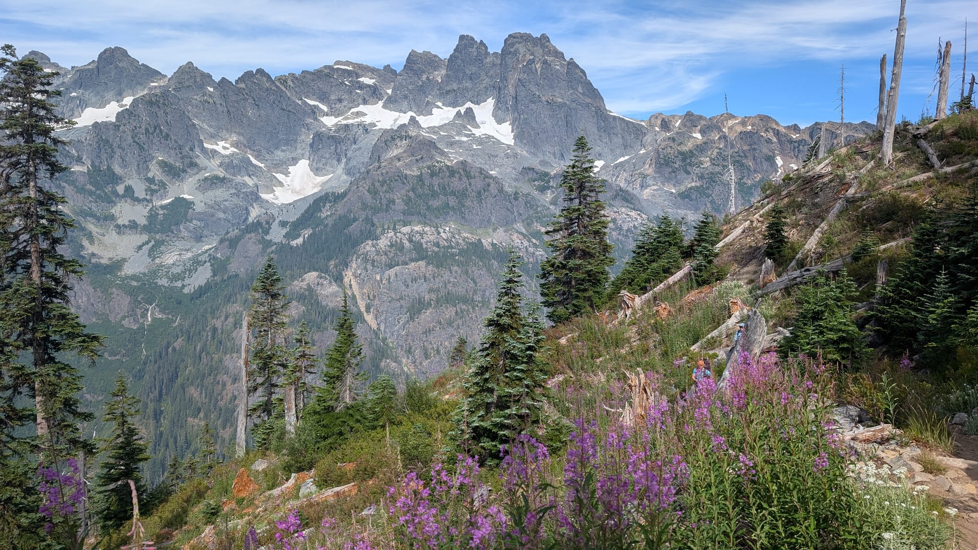
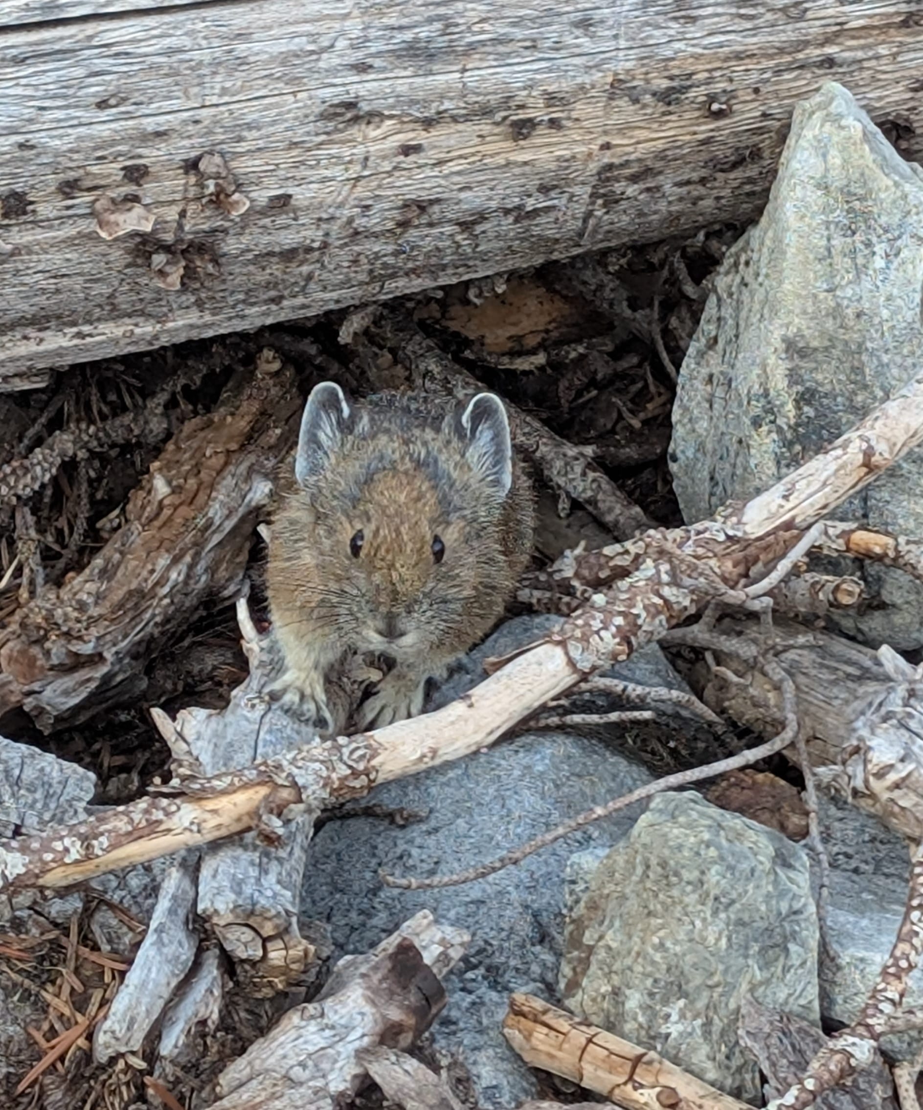
Views from Escondido Ridge, us along the Ridge and a new friend (its a Pika!)
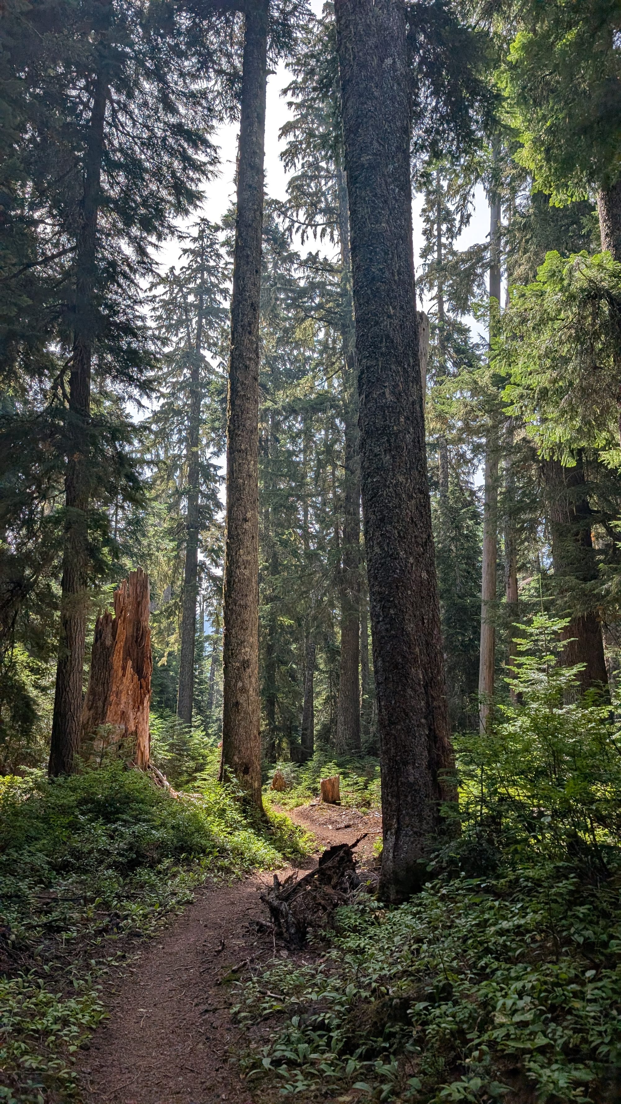
Many switchbacks down to Lemah Meadows, landing us in a very bathable forest. We stopped at the second crossing of Lemah Creek, where the bridge has been long out, for a lunch break and foot soak after the 17 miles done yesterday. From there it was about 6 miles to Spectacle Lake through a burn zone, covered with purple fireweed (beautiful despite the name).
A very bathable forest and fireweed a long the trail to Spectacle
Spectacle can be quite popular, and we saw six parties descending. It can be accessed for the low price of 22 miles round trip, compared to 56 miles on the PCT from Stevens Pass. The descent to Spectacle is rooty and rocky, with occasionally large steps down. We found a nice spot on the isthmus, and spotted ~3 other tents as we arrived around 3pm. Even on a Sunday night this did not last. At least three other parties, with 10 people total arrived at the lake after 6pm. It was cozier than preferred, with a party camped less than 50 yards from us. We saw ~21 people this day, including 5 NOBOs, and ~15 backpackers and hikers in this more accessible section.
We watched clouds sitting at the crest towards the Lemahs and enjoyed another foot soak. Brian and Jeremy plunged in for a full lake experience. We had birria tacos for dinner and enjoyed some makeshift margaritas.
Day 5 Spectacle Lake to Snoqualmie Pass TH 18 miles (4029 gain)
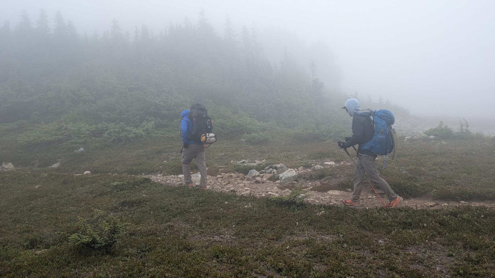
On our final day of the trip, we should be home free right? We decided on a 7am call time and woke up at 5:30am. It was a beautiful morning at Spectacle. The marine layer on the other side of the crest remained, but did not drop into Spectacle. In the morning, we had a short ascent up and toward the intersection with the Mineral Creek trail, near Upper Park Lake. It became clear the marine layer would be persistent, so we put on more layers, anticipating windy conditions and cooler temps.
Morning at Spectacle Lake and the beginnings of the Marine Layer on our final day
As we ascended from the Upper Park Lakes area, the trail got rockier, where I tend to move slowly and be more cautious with my steps. This was my first sign it might be a challenging day. As we began the traverse, we dropped into chillier temps and clouds on the other side of the crest. Sections of a trail where it feels exposed are tough for me, meaning you suddenly realize how high up you are. Everyone has a different perception of exposure, and I was feeling it here, especially with loose, large rocks making up the trail.
I moved slowly through this section, with Jeremy close for sections where I felt uncomfortable. I focused on looking at the back of his shoes to keep me moving. The cloud cover was a bit of a blessing in disguise, as I couldn’t see how high up I was. I made it through the tough sections, with many deep breaths, positive self-talk, and feeling done with the terrain.
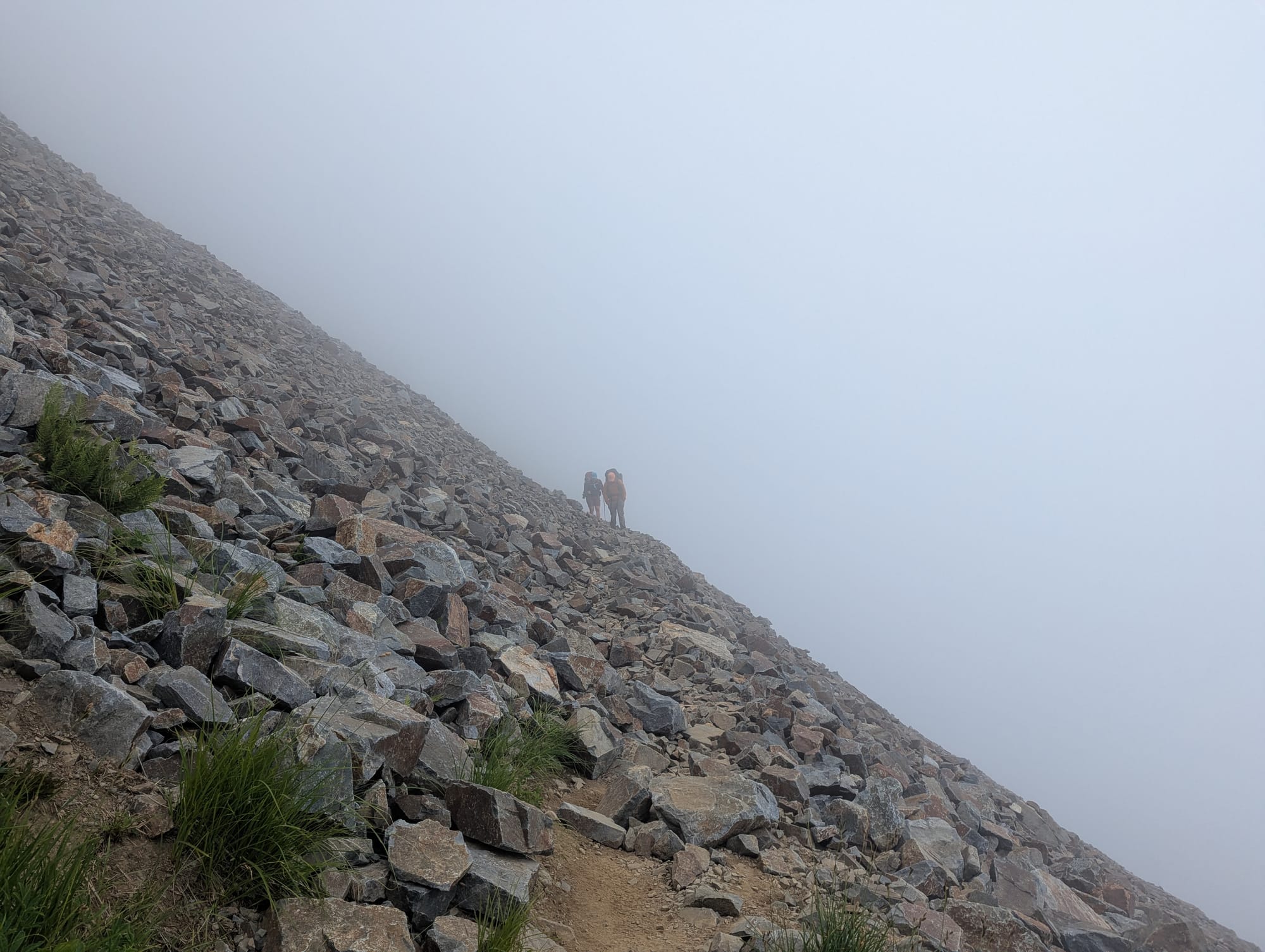
This section is my favorite (passing under Chikamin Peak) and continuing our descent in the clouds
As we descended, we stopped to let folks pass coming up. A eager dog was with them, running up the trail with excitement. As they got closer, I realized I knew one of them - “Brand?". It was a former colleague from Metro, who happened to be hiking Section J from the Snoqualmie side. That's how small the transportation world is in Seattle, but a welcome surprise to see a familiar face on the trail. The marine layer persisted, leaving us with only views of the Joe, Alaska and Ridge Lakes as we passed above.
From Ridge Lake, you are less than a mile from Kendall Katwalk. We took a short break there to prepare for the 2600 foot descent and six miles to the trailhead.

It was a long and tedious descent through rooty, rocky terrain on very tired feet, while feeling a few hot spots. I was motivated to keep moving, knowing the car, clean clothes and real food for dinner awaited me.
After 18 miles, I've never been happier to see the roof of a Forest Service restroom, which signaled the trailhead. Out of exhaustion, out of victory, out of what it took to get here, I let out a long yell at the trailhead. It felt releasing, and comforting. It was a hard exit day, but it reminded me of what is possible, that I can do hard things, and my resilience, depleted in recent years, returned.
Tahoe
With tired feet, Jeremy and I headed to Tahoe just two days later, to meet my friend Sarah and her family. We originally planned a two night backpack in the Desolation Wilderness, but post PCT, a one night backpack seemed more reasonable with cabin time near the Palisades ski area.
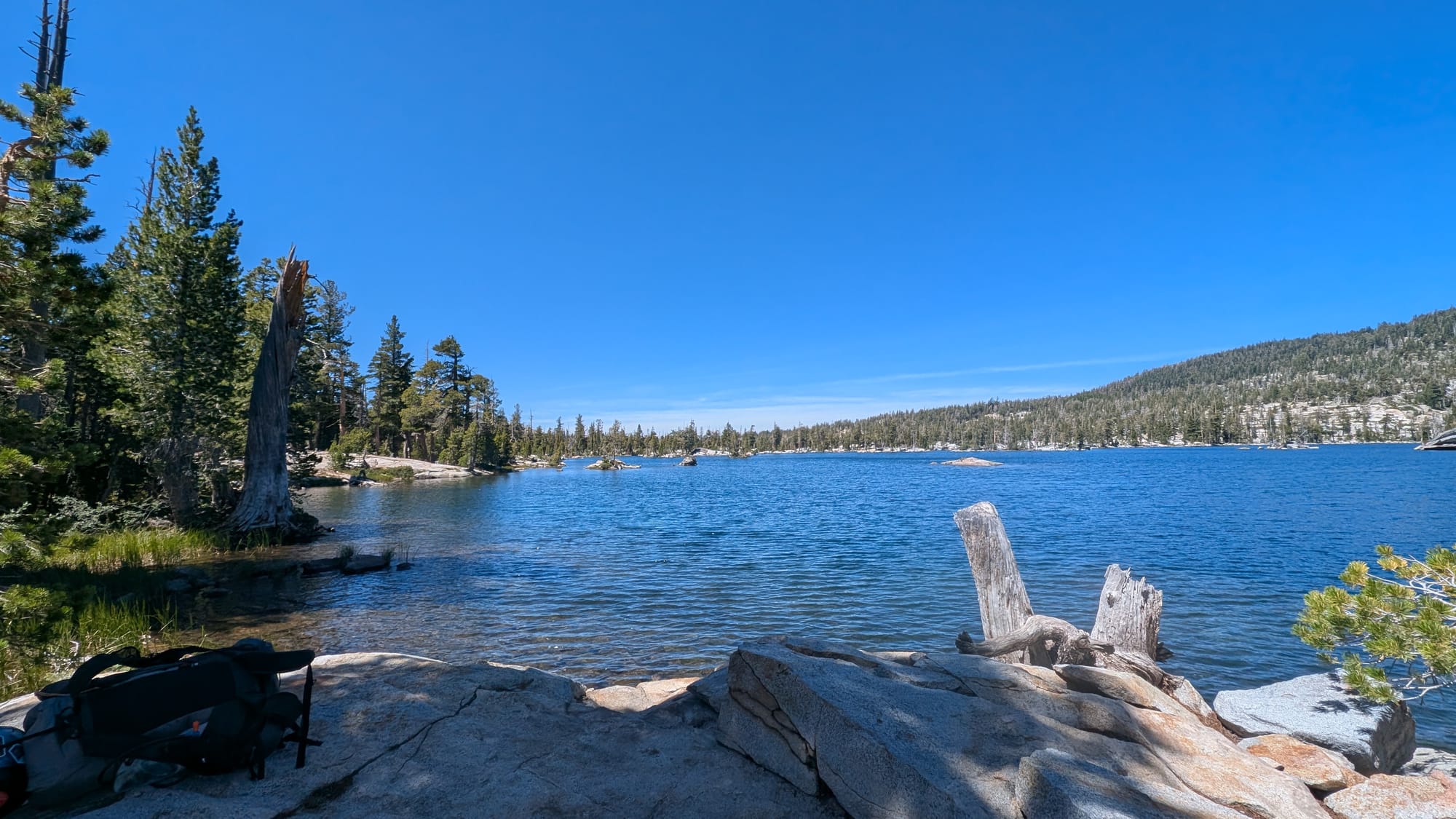
The Desolation Wilderness area is amazing with many beautiful, accessible, granite lakes, sometimes within 4-6 miles of hiking. We set out Thursday morning, stopping at Middle Velma for lunch and then enjoying a leisurely afternoon in the sun at Fontanillis Lake, where we camped overnight. This took me back to the PCT, but California Section K this time.

Middle Velma and Fontanillis Lake
In the morning, we headed up Dicks Pass. Three years ago, we did a backpack to Grass and Susie Lakes, with a visit to Lake Aloha, which you can see from the pass. Our exit out was via Eagle Falls trailhead, a very popular and accessible trail with many day hikers. After our exit, we stopped to enjoy lunch on the west shore of Tahoe.
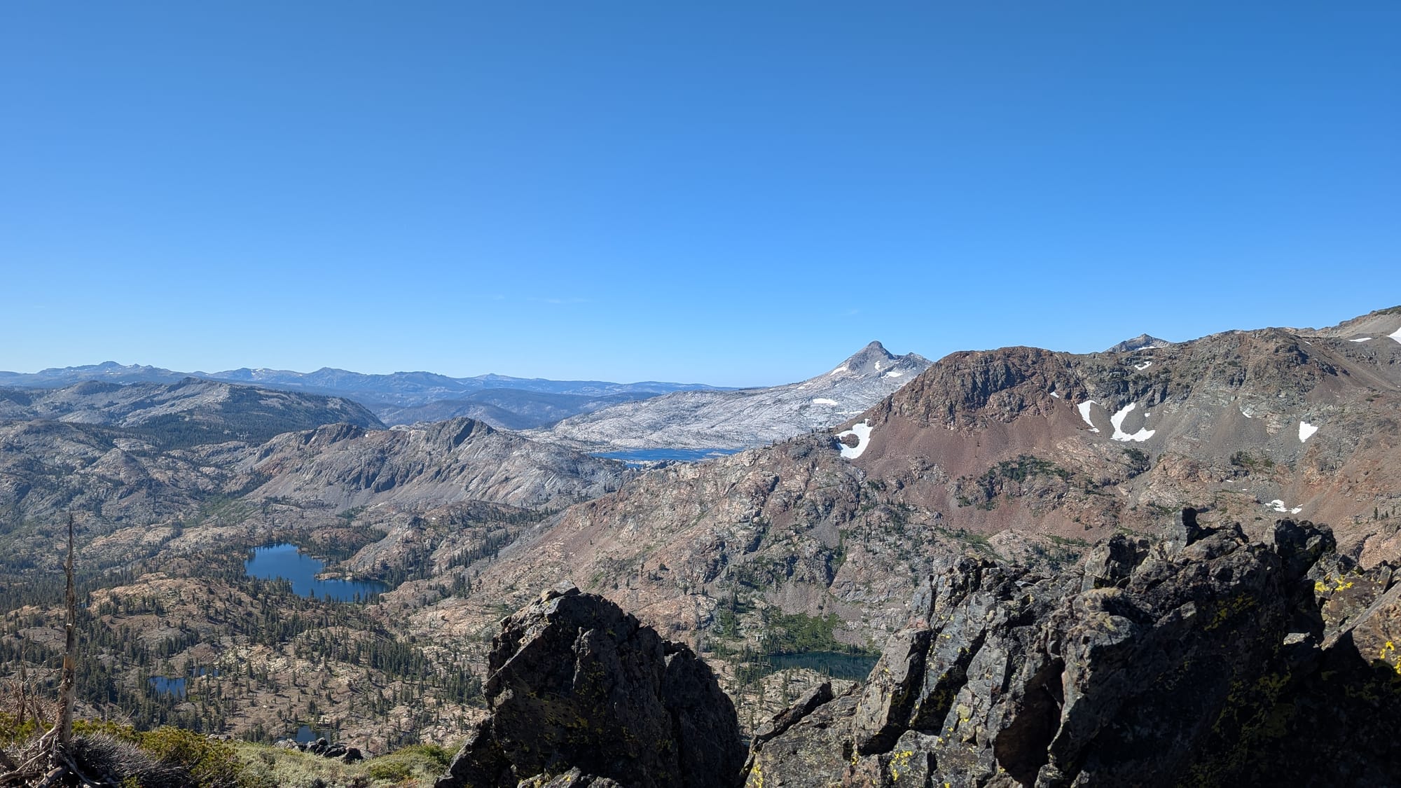
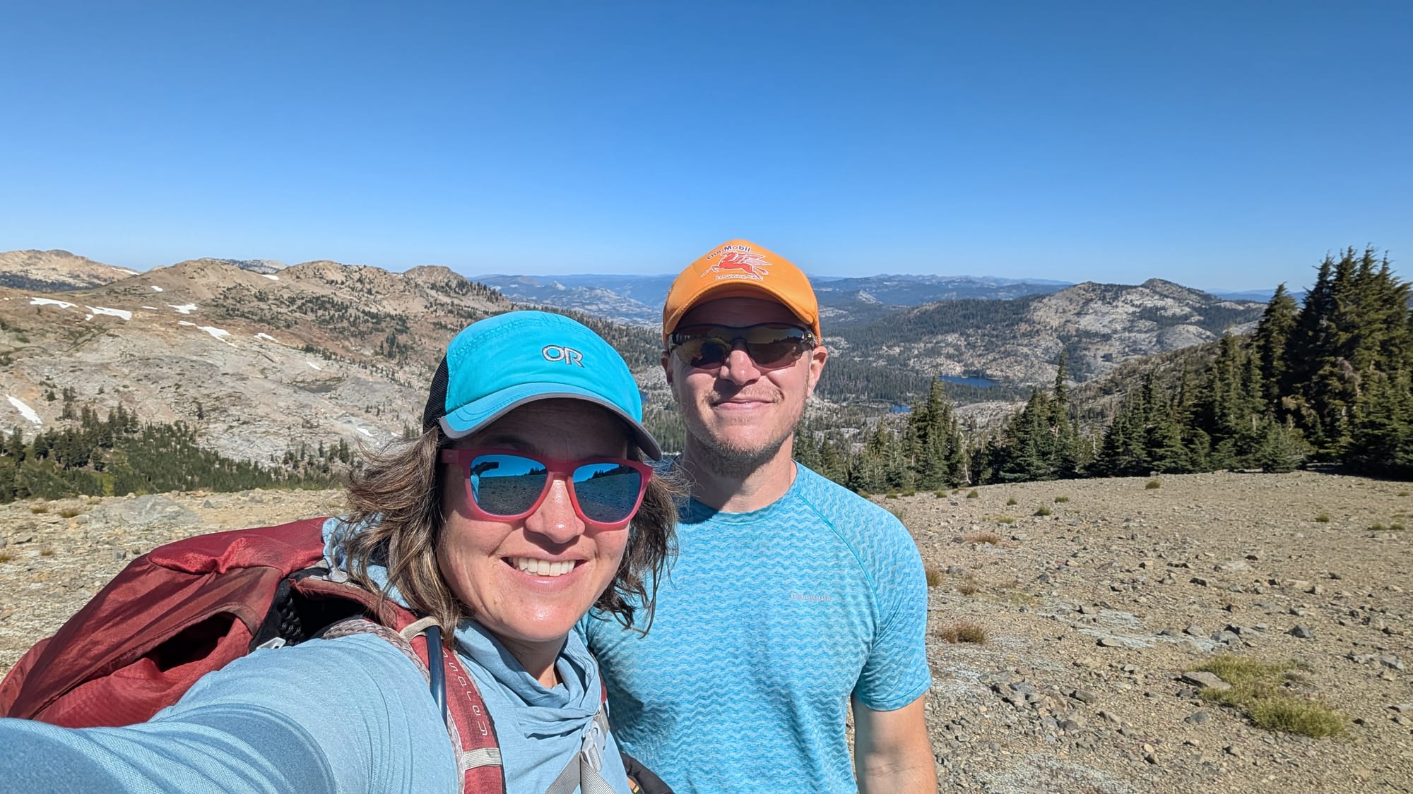
View near Dicks Pass, Susie and Lake Aloha and Jeremy and I with Dicks, Fontanillis and Velma Lakes in the background
To round out our adventures, we did a whitewater rafting trip along the Truckee River. We had a great guide, Paul (who reminded us of actor Jason Lee) and paddled through some Class 2/3 rapids with his guidance. As we traveled through the Class 3 "Jaws" rapids, we proudly did not lose our boat. A quick trip, and wonderful time with friends in a beautiful part of California.
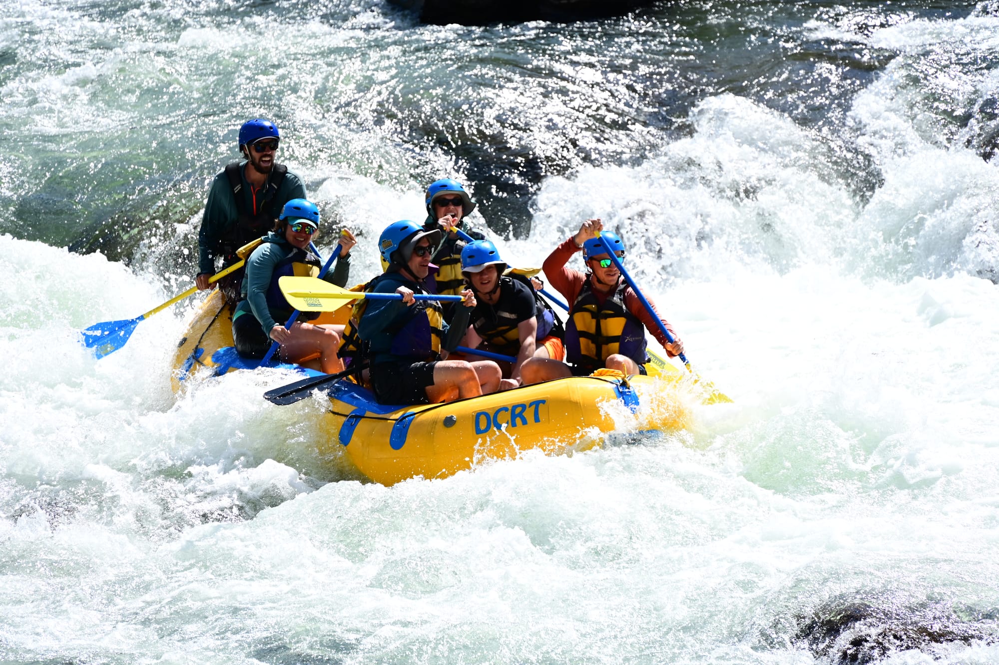
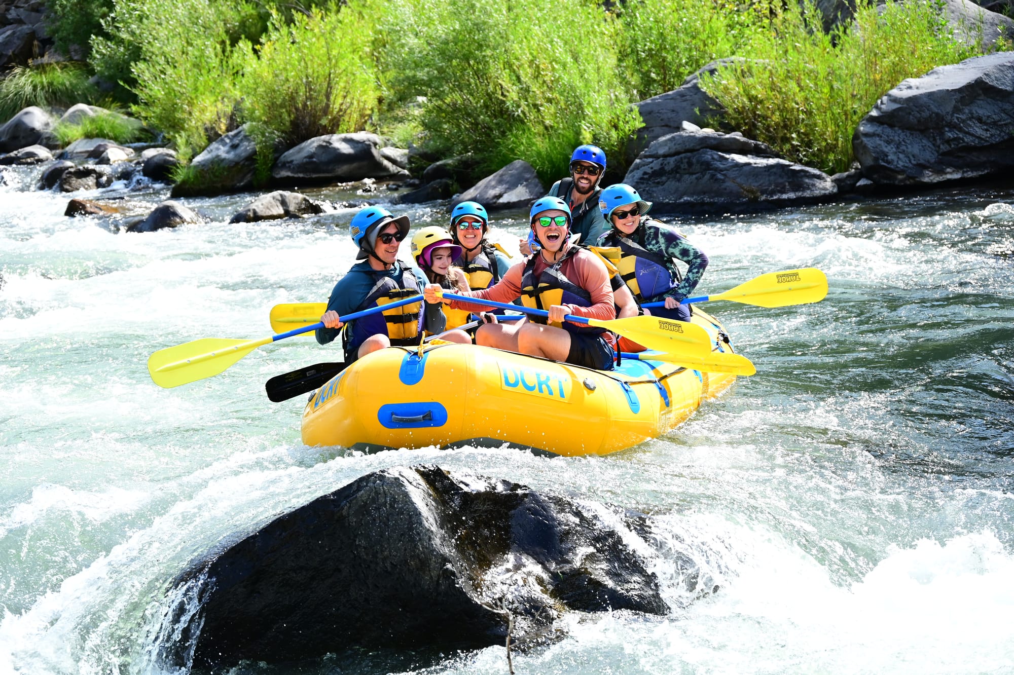
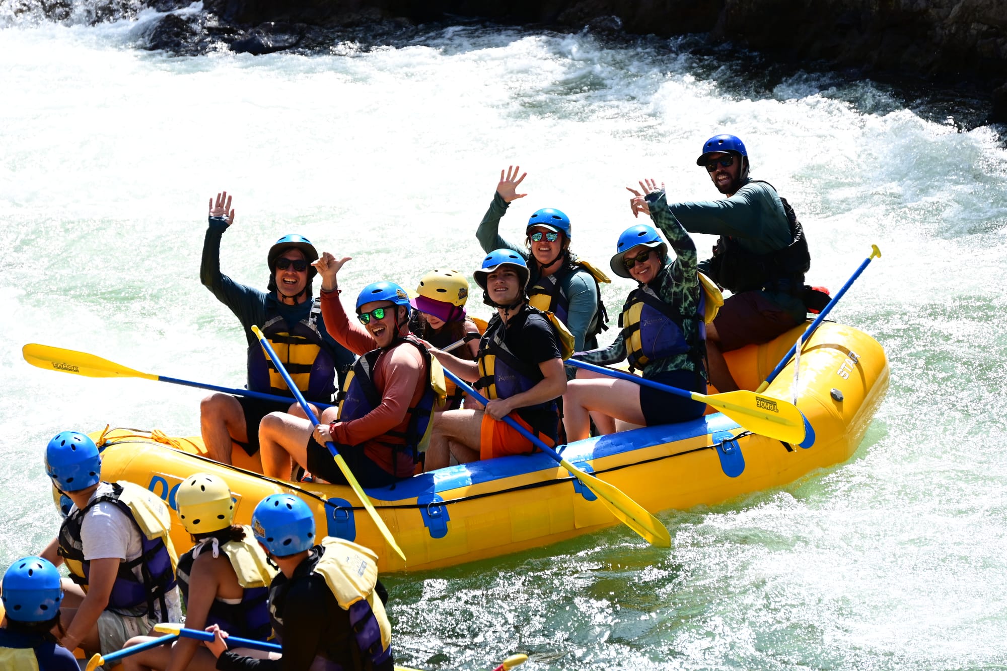
Whitewater Adventures on Truckee River (photos by Base Camp Adventure Photography)
What's Next?
We are driving to California in late August for our backpacking trip that includes Mount Whitney (taller than Mount Rainier and the highest point in the contiguous United States at 14,505 feet). I have been thwarted from this trip every year since 2020, so eager (and hopeful) for this to happen!